


Characterization of the tropopause in vicinity of thunderstorms.
 |
The altitude of the tropopause near thunderstorms is an important feature to understand in order to quantify the transport of air and water vapour between the troposphere and the stratosphere. Two fundamentally different types of satellite observations could improve our understanding of this hard accessible phenomenon. The vertically viewing imagers are very good for determining where the storms are located but they have poor vertical resolution, while the horizontally viewing radio occultation satellites scan large horizontal regions with great vertical accuracy. These two data sets could be combined to provide new knowledge about the tropopause near thunderstorms.
The strange habits of the Quasi Biennial Oscillation (QBO).
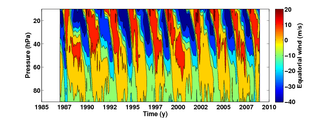 |
The QBO is a naturally occurring oscillation of the stratospheric wind patterns, that has remained remarkably stable for at least 60 years. Phenomenologically the QBO is observed as an oscillation between easterly and westerly tropical stratospheric winds, with a period of approximately 2 years. The period varies quite a bit, and maybe these variations could be explained? The QBO is maintained by gravity waves partly originating from tropical thunderstorms. Today we can monitor the thunderstorm intensity from satellites. Can we establish a connection between thunderstorms and QBO features?
Do airplane contrails seek clear skies?
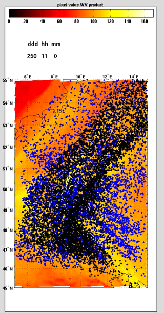 |
Cyclonic systems emits air masses in the upper troposphere, and these air masses drifts towards the upper troposphere above clear sky areas in the surroundings. Airplane contrails sit in the upper troposphere. Does this imply that contrails tends to gather above clear sky areas? If yes, can we quantify the phenomenon? And does this process then affect estimates of contrails contribution to global warming? It could either be a study based on models or on satellite observations -or both.